Stable visible vertical features
Laser navigation needs visible, stable, significant reference features with vertical surfaces along the route.
Site assessment starts with what the robot can see and localize: route features, ground condition, reflective landmarks, moving objects, glass, corridors, and docking precision.
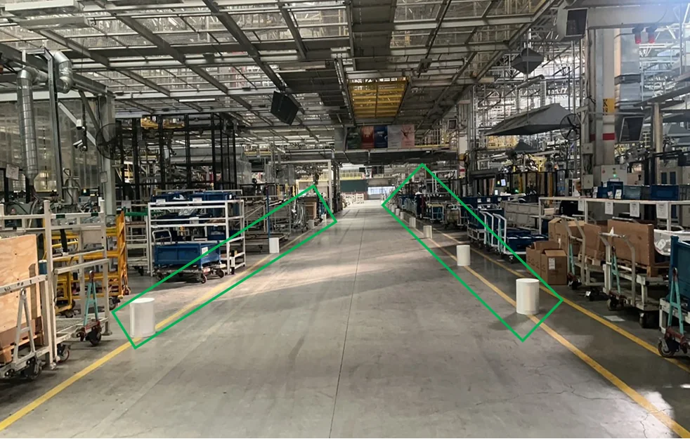 Source: AGV-SRC-02-site-assessment
Laser navigation needs visible, stable, significant reference features with vertical surfaces along the route.
The source warns that obvious floor fluctuation can reduce scan quality and localization accuracy.
Long smooth corridors may need reflectors or added reference features because the scan resembles parallel lines.
Areas where more than half of scanned objects move may need reflector columns, reflector strips, QR, or texture-code options.
Glass point clouds may need removal and additional landmarks where transparent surfaces dominate.
The source describes hybrid laser plus QR or texture-code navigation for precise docking points.
The fastest useful RFQ includes route photos, floor notes, slope notes, fixed-feature locations, and any areas where landmarks cannot be installed.